1
/
of
1
Minnesota and Dacotah in 1860
Minnesota and Dacotah in 1860
Unit price
/
per
Sale
Sold out
Couldn't load pickup availability
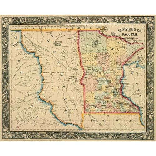
Minnesota and Dacotah in 1860 is reproduced from a map in Mitchell's New General Atlas, published in Philadelphia in 1860 by S. Augustus Mitchell, Jr., who succeeded his father as one of the most prolific publishers of maps and atlases in the United States during the nineteenth century.
The New General Atlas replaced Mitchell senior's equally popular New Universal Atlas (1846 - 59) and remained in print through later editions until 1893. The atlas was produced by lithography with color applied to each map by hand. Minnesota and Dacotahnull was apparently based on a combination of sources that included Joseph N. Nicollet's 1843 map of the Hydorgraphical Basin of the Upper Midwest River and Lt. Gouverneur K. Warren's 1858 Military Map of Nebraska and Dakota.
- 20" x 16"
Share


