1
/
of
1
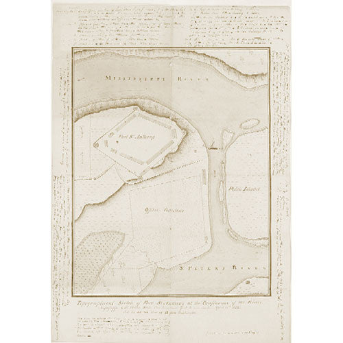
Topographical Sketch of Fort St. Anthony (Fort Snelling), 1823
Topographical Sketch of Fort St. Anthony (Fort Snelling), 1823
Unit price
/
per
Sale
Sold out
Couldn't load pickup availability
A topographical sketch of a map of Fort Snelling drawn by Sergeant Joseph E. Heckle, together with descriptive notes written in its margins by Major Josiah H. Vose, 5th Regiment, U.S. Infantry, gives important insights into the fort's construction and early operation. Before this map's discovery in 1997, historians and archaeologists relied on plans of the fort drawn in 1821 or 1822 and a map made in 1835 to guide their restoration work.
Format: 24" x 36"
Share


